
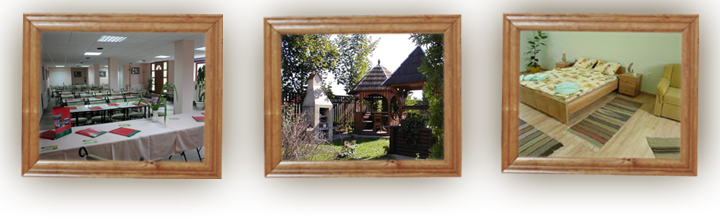
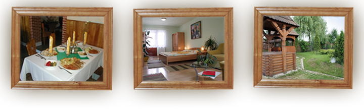
One day trips
One day trips: why Odorheiu Secuiesc?', '
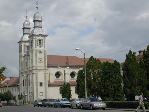
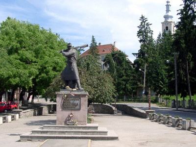
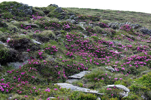
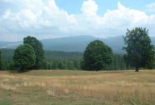
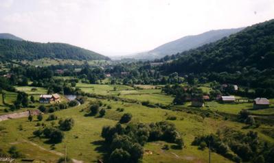
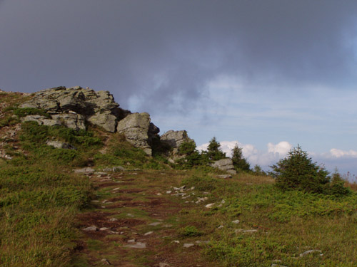
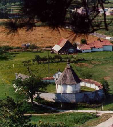
Transylvania, is the conserved beauty of former Europe. There are few places on this continent where you can travel and still meet authentic culture like that of the Transylvanians. This land is also caracterized by rough mountains cliffs, mysterious lakes and "virgin" forests. Among theese beauties we can found Odorheiu Secuiesc (Székelyudvarhely). Its environs have been inhabited since ancient times. This fact is proved by the finds which have been excavated in this area, such as stone tools, and pottery from the Neothic era, bronze tools and objects belonging to the early Iron Age. On the place where the ruins of the Székely Támadt fortress can be found today, there was established a Roman castrum (military camp). The fortress built on the Budvár and the pottery finds here belonging to the 11th and 12th c. The Seklers from Udvarhely are first mentioned in the document in 1224. The only monument which remained from this period is the Jesus Chapel, which can be found at the edge of the town on the left side of the road to Segesvár.
 |
 |
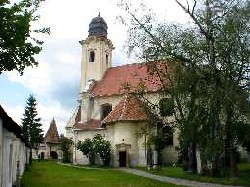
Another important factor in the development of the town was the two secondary schools: the first is the Jesuit school which had been functioning since 1593, (the predecessor of the today& 39;s Tamási Áron high-school). The second was the Reformed College which was founded in 1670, (the today& 39;s Benedek Elek Teachers& 39; Training School). At the beginning of the 18th c. the town was tried by the wars and by a devastating plague, but after all these its economy recovered again. This is reflected by the Baroque monuments which were built: between 1712 and 1779 the Franciscan Church and Nunnery, the Reformed Church ( 1780 - 1781) and the Catholic Church (1787-1793).
The revolution from 1848-49 and the following totalitarian regime restrain the development of the town but around the 60& 39;s of the XIX century we can witness the advance of the embourgeoisement and urbanization. The increasing cultural demands of the merchants and craftsmen are satisfied by different cultural societies and clubs. The school network is enlarged. In that the age of dualism represented the most dynamic period in the development of Odorheiu Secuiesc which determined the today& 39;s look of the downtown.
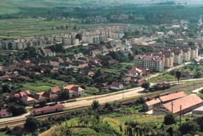
After the World War II came the socialist regime, a period of contradictions. The population of the town increases, it is four times larger. The villages become depopulated. The people from the countryside are moved to town where they become proletarians but they can not adjust themselves to the requirements of a town life. The large-scale industry was born. But most of them haven& 39;t been able to face the conditions of the free competition of our decade. All these represent our inheritance of several centuries which makes us hope that hardships of the transition period will pass, and Székelyudvarhely will become again a flourishing settlement, where the patina of the past and the economic prosperity will be in harmony.
- AGYAGFALVA (Lutita) - the 1848 memorial - Reformed Church from the 13 -th century- SZÉKELYKERESZTÚR (Cristuru Secuiesc) - the Cathoic curch from the XV-th century - the Gyárfás mansion - pet?fi S& aacute;ndor’s pear tree - FEHÉREGYHÁZA (Albe?ti) - Pet?fi Sándor memorial house - SEGESVÁR (Sighi?oara) - the Wach Tower museum: the exhibition about the history of the castle and the guilds - the old town and the medieval tight streets give the impression of the medieval German town - SZÉKELYUDVARHELY
: along the wide valley of the Târnava River at two hills beyond which the panorama opens before the eyes, here is the little town of Sighisoara. The thousand-year old history of this wonderful town is an example of the peaceful co-existence of the peoples: the Romanians, the Hungarians and the Saxons. The town and the picturesque fortress were born in the Middle Ages. Archeological diggings around the town revealed a lot of stone, bronze and iron tools used by local people. The dark walls, the majestic towers and the colourful houses of the uptown appear suddenly before the traveller’s eyes and create a deep impression. Time seems to have stopped in the old, narrow streets.
The town started to gain importance after the arrival of the Saxons in the XIV-th centuryes. The walls measured 930 m in length and were guarded by 14 towers built by different guilds. This old town has preserved its character of a medieval Saxon town and, together with the Town Hall in German Renaissance style and the meadows, is unique in the whole country. Until the end of the Middle Ages the fortress was the centre of the town, then the downtown built at its feet gradually gained importance.
 |
 |
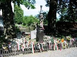
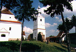
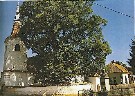
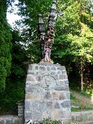
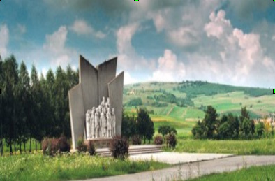 LUTITA he name of Lutita is closely connected to the Szekler national assembly of 1506 as well as with the events of the meeting of 1848. These historical events were of great importance for the Szeklers. The acceptance of the regulations concerning the Szekler autonomy is also connected to this village and also here was made the appeal to the Romanians and Saxons of Transylvania calling on solidarity in 1848. The 1848 monument can be seen from the no. 137 road. It was inaugurated in 1990. The Gothic Reformed Church encircled by small tiled stone-wall stands in the centre of the village and it was built in the 13th century.
 Cristuru-Secuiesc is the most significant economical-organizational and educational center of the Cristuru basin. Developed from district residence, region center and large commune into a market-town and then town. Today it is one of the small towns of Harghita county with 11.185 inhabitants together with Filias. Opposite to the cinema on a small square, one az see the statue of Petõfi Sándor, made by András Márkos sculptor (1971). Also in the downtown, one of the beautiest bronze statues of the great romanian revolitionary, Nicolae Balcescu, is made by Mircea Spãtaru in 1971. One of the oldest historical building of the whole region of Cristur is the Roman Catholic Parish Church situated in Libertatii square, which was built in late Gothic style before the 15th century. The Molnár István Museum and open-air ethnographic section are one of the most significant country museums of the region and the whole county. It has valuable ethnographic- folk- art- and natural history permanent exhibition.
The Gyárfás-mansion is a historic monument of Harghita county in classicist style. Unitarian church together with the tower was built between 1781-92. Its style combines Baroque and Classicist elements.
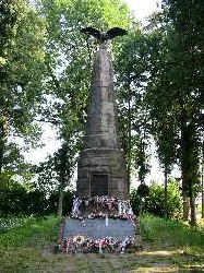
ALBESTI This village lies 5 km from Segesvar, on the E60 road leading to Brasov. The name of the village comes from its white walled church standing in the place where today there is the Reformed church built in 1440. Albesti guards the memory of Petõfi. At the end of the village, on a hill, surrounded by trees is the obelisk with the eagle erected in 1897 and the Petõfi Memorial House. Both cherish the memory of the soldiers who died in the battle on July 31, 1849. Leaving the village and travelling towards Vânãtori there is the monument at Istvankut, the place where the poet may have died. Petõfi was last seen here and the official version about the circumstances of his death names Albesti as the place where Petofi died on July 31, 1849 and he was buried here in a mass grave.
 |
 |
2. SZÉKELYUDVARHELY (Odorheiu Secuiesc) - MÁRÉFALVA (Satu Mare) - well known for the famous carved Sekler gates - HOMORÓDFÜRDÕ (Bãile Homorod) - holiday resort - mineral water springs - CSÍKSZEREDA (Miercurea Ciuc) - the Mikó castle - the Sekler museum- the Roman- Catholic church - the Márton Áron Secondary Grammar School - CSÍKSOMLYÓ (?umuleu Ciuc) - the Mary shrine and the scene of the famous Pentecostal pilgrimage - TUSNÁD (Tusnad Bãi) - the world famous spa and tourist attraction - SAINT ANNA LAKE (Lacul Sfânta Ana) - the beautiful volcanic crater lake in Csomád Mountain, the only intact volcanic crater lake of Eastern Europe - BÁLVÁNYOS FÜRDÕ (Bãile Balvanyos) - the sulphureous ’Stinking’cave, the famous mofetta - the bird cemetary - ’Buffogó’ is an one hectar land rich in acid water upsurge. In its bogs the mineral water bubbels loudly, you can hear this from large distances - SZÉKELYUDVARHELY
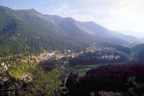
BAILE HOMOROD:The bath is situated in the valley of
Homorodul Mare on the height of 740-760 m above the sea level. It is 18 km away from Odorheiu Secuiesc. In the past it was a small settlement at the foot of the mountain with fizzy warm and cold baths, today it is a youth holiday camp with national significance, with mineral water springs. The climate is typical: the summer is warm, the winter is cold with changing winds. The mountain climate is good for recreation and healing. The small holiday camp is one of the stations of the transit car-tourists. The characteristic of the springs are: high proportion of the microelements (Li, Mg, Br, J). Can be utilised for drinking cures, and also for drinking. The well known mineral waters of Homoród were used
In the Roman times. The ruins of "Földvár" are situated on the Láz, near the old roman road, a 36x36 m square Roman guarding tower. The Roman castellum (guarding tower) figure as archaeological reservation in the official monuments catalogue of Harghita county.
 |
 |
MIERCUREA CIUC: it is the administrative centre of Harghita County, on the left bank of the Olt River in the Ciuc Basin.
Miko Fortress is the most important monument of Miercurea Ciuc. The fortress was built from 1623 to 1631 in neo-Renaissance style. The builder of the fortress was Count Mikó Ferenc of Hidveg. Mikó Ferenc received the “princiary domain of Szereda” from Prince Gabor Bethlen. The institutions of the former Ciuc District were built around the fortress. These were the headquarters of the Seckler border regiment, the County Hall and the impressive Law Court. Today the fortress houses the Seckler Museum of Ciuc. In the yard of the fortress are held festivals of early music every summer. On the square behind the fortress was founded a Village Museum in 1969, the cottages and gates are representative pieces for the folk architecture of the Ciuc Basin. The permanent displays of the Seckler Museum of Ciuc are of ethnographic, religious and bibliographic character. The documentary section of the county library is also to be found here.
The Roman Catholic Prish Curch is the oldest building of Miercurea Ciuc which once offered shelter to the whole population of this Catholic town. It was built in 1758 in Baroque style.
The building of Márton Áronn High School. was erected in the period from 1909 to 1911 in secessionist style. In 1990 the school took the name of Márton Áron, a Transylvanian bishop who once was a student in this school. In front of the building we can see the bust of him, the work of the sculptor Bodó Levente from Vlãhita. The sculpture was unveiled in 1997.
 |
 |
JIGODIN: - Today Jigodin belongs to Miercurea-Ciuc, together with Jigodin Baths. Its name is closely related to the works of Imre Nagy, the famous Szekler painter (1893-1976). The village has completely grown into the town along the Jigodin road or Castle road. The village is situated at 660-680 m altitude.The Nagy Imre Art Gallery was built in 1973. He left over 6,000 pictures to the town. The painter& 39;s native house is a simple peasant one next to the gallery. His personal objects, books, pieces of furniture can be seen inside the house together with an unfinished composition on his easel. The Roman Catholic parish church is registered among the historical monuments of Harghita county. The church was built in Gothic style, in the 15th century.
The Jigodin Pass marks the border between Upper and Lower Ciuc. Several mineral water springs can be found here, fact that actually helped the creation of Jigodin Baths.
 |
 |
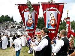
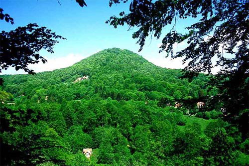
SUMULEU: - which once was the centre of Ciuc District, today is the suburb of Miercurea Ciuc. It is 3 km from the centre of Miercurea Ciuc, at an altitude of 705 m. Behind the village we can see the twin volcanic peaks of Kis-Somlyó and Nagy-Somlyó covered with beech forests. Since its foundation ?umuleu has been the centre of Catholic faith and culture. For more than550 years it has been the centre of the spiritual life of Ciuc District and a well-known place of pilgrimage. The Whitsun (Pentecost)pilgrimage and the Thousand Seckler Girls meeting (first held in 1931), draws huge crowds here. It is the centre of the Roman Catholic Secklers and Hungarians from Moldavia as well as of the Franciscan Order from Transylvania. ?umuleu is particularly attractive for its historic past and monuments. The monuments of ?umuleu are unique in Transylvania. The most important monument is the miraculous statue of Our Lady, which represents a woman who is attired in Sun. The Crying Madonna is a masterpiece of the ecclesiastic art of the 16th century. Sumuleu has become the symbol of Hungarian unity and endurance.
 |
 |
TUSNAD SPA - SAINT ANNA LAKE: is situated in the valley of the Olt river, between Southern Harghita mountains and Ciumatul volcanic massif, balneo-climateric health-resort at 650 m above sea level. Accessible through National Road no. 12 between Sfantu Gheorghe and Miercurea-Ciuc and railroad line 400, between Brasov and Ciceu.
A total of 44 springs can be found here, which from 6 are used currently, four of them (Stãnescu, Apor, Ileana and Mikes springs) for external treatments (baths). As internal cure are recommended for the following diseases: Cardio-vascular system ,chronical gastrithis chronical hepatho-colecistites, digestive system .As external cure: metabolic system, rheumatic, cardio-vascular system,neurasthenias, diseases of the locomotory system.
SAINT ANNA LAKE (Szent Anna tó), near Tusnádfürdõ, lies in the crater of a dead volcano, the Csomád, at an altitude of 950 meters. In the prehistoric ages, there were other lakes in the crater, which, by now, got filled up with decaying remains of old trees, dry leaves, and the area turned into a bushy, lightly forested, boggy land, called the Mohos-láp. It becomes a very dangerous place, especially after long rainy periods, when the soft peat becomes so marshy that it inevitably sucks down everything heavy. The Saint Anna lake is surrounded by legends, mysteries and miracles. Even the shape of the lake is not usual; it looks like a large tear-drop. The lake is not fed by any brook or stream, the only water supply is the rain, therefore, the waters of the lake is nearly as pure as distilled water. The area of the lake was not only believed to be a hiding place for pagan gods, but also has been and still is one of the most respected sacred place for the Christian Seklers. Pilgrimage to the Saint Anna lake has been a custom since the 12th century, which is confirmed by documents telling about a wooden St. Anna chapel by the lake. By 1564, a stone chapel was built, and the popularity of the pilgrimage reached its apex during the 17-18th centuries when 30,000-40,000 pilgrims gathered here, and the event lasted for days. It became a tradition for the young to gather here every year, to find a partner, under the guardianship of Saint Anna, who made sure that the young find one another. Saint Anna, mother of Virgin Mary, was the patrona of the young adult girls and the expectant mothers, but the infertile also prayed to her for pregnancy. The Saint Anna lake remains a common gathering place for the Sekler youth, even today.
 |
 |
3. SZÉKELYUDVARHELY (Odorheiu Secuiesc) - SZEJKE (Bãile Seiche) - holiday resort and spa - the tomb of Orbán Balázs, the biggest Sekler - FARKASLAKA (Lupeni) - Tamási Áron’s native house - the memorial tomb of the famous sekler writer - KALONDA PEAK - coal burning place between the two villages - KOROND (Corund) - the transylvanian center of folk pottery - ceramics fair - PARAJD (Praid) - the salt mine and the natural salt mountain - SZOVÁTA (Sovata) - Bear lake, the heliothermal salty water - SZÉKELYUDVARHELY
LUPENI: - is the place where is the tomb between the two oaks behind the church, of the well known writer, Tamási Áron.The tomb is a work of Szervátiusz Jenõ and Tibor(1972-1974) and it presents the values of Tamási`s work and artistic creed. The rock of the monument is andesite, it is three meters tall and more than one meter width. It represents some of Tamasi& 39;s heroes. Tamási said: "We have come to this world to find our home somewhere..." Tamási Áron Memorial House: In the big room of the house is a Tamasi memorial exhibition with original furniture from Lupeni and with the writer& 39;s cradle. We can also see a collection of Tamasi’s writings, letters and photographs.
 |
 |
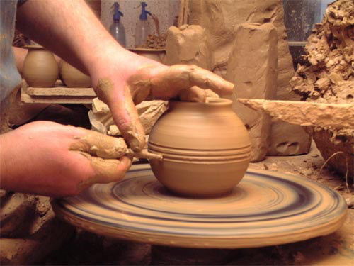
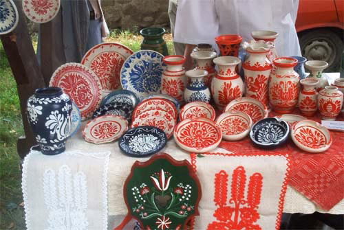
CORUND: - is one of the most well known settlements in the country-side which name is inseparable from the folk-ceramics, from the national pottering.
It lies along the 13A road, 29 km from Odorheiu Secuiesc is the most famous settlement of the Salt Region and a living centre of folk pottery. The village had an aragonite mine, now is closed, and in the 19th century a nationally known mineral water bath which became famous before the one at Sovata was opened. The inhabitants of village have different and varied trades: the traditional pottery, woodworking, tinder working and commerce. It plays an important part in the commercial, educational and touristic life of the region. In the fair along the main road tourists can choose from pottery, hay and bulrush mattings, woollen and wooden articles, utensils and ornaments.
 |
 |
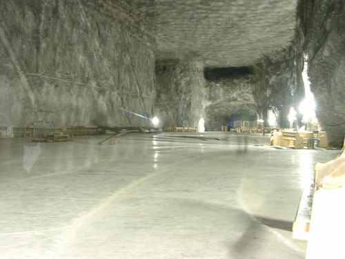
PRAID: - is famous for his salt-pit, it is a typically mountains settlement. Praid is the natural centre of the Salt Region, one of the most important salt mines of Transylvania. The underground salt mountain once supplied the whole Seckler and Saxon lands with this indispensable mineral. The history of the village is linked to the salt.The salt mountain is a geological rarity in itself. The 1600 m thick salt rock contains approximately three billion tons of salt which would cover the needs of the whole population of the Earth for more than four hundres year. The salt mine and salt bath of Praid are well-known all over the country.
The entrance to the mine is close to the road. Visitors and asthmatic patients are taken by the buses of the mining company from the surface entrance into the mine, close to the exploitation level and to the curative places for asthmatic patients. The bus goes down on a mild slope in a 1500 m long tunnel 80 m under the ground into the salt rock,280 m below the entrance.
The salt exploited here is grey in colour and is of very good quality. Only 100 miners work here and six hundred tons of salt are exploited daily.
 |
 |
 SOVATA - BEAR LAKE: - is the most popular summer resort and spa of the Land of the Secklers. Sovata is in the so-called Salt Region which was given this name owing to the thick salt layer under the ground. The Bear lake lake received his name because its shape resembles that of a bear leather hide spread out. The temperature of the water rises as we go deeper and deeper. Close to the surface it is around 20 degrees C, but in a depth of one meter and a half it can reach 50-60 degrees C. If too many people bath in the lake this difference in temperature is not so great. The cause of this phenomenon is the fact that the concentration of the salt is higher as you go deeper. The sun heats up the deeper layers quicklier and these layers preserve the heat for a longer time. This heliothermic phenomenon is very rare. During the summer season one can take a bath in Bear Lake. Near Bear Lake there are smaller lakes, like Mogyorosi Lake where you can bathe, Green Lake, Red Lake and Black Lake. These lakes take their names from their colour. The mud from these lakes has curative effect. The water of Bear Lake has been used to cure infertility, but it is good for rheumatism and inflammations as well.
4. SZÉKELYUDVARHELY (Odorheiu Secuiesc) - CSÍKSZEREDA (Miercurea Ciuc)- MADÉFALVA (Siculeni) - monument: a tribute to Siculicidium, the seklers murdered by Austrians in the late XVIII century - GYERGYÓSZÁRHEGY (Lãzarea) - the medieval castle of the Lázár family - GYILKOSTÓ (Lacu Rosu) - the Killer lake - dam - BÉKÁSI SZOROS (Cheile Bicazului) the Békási Straits - SZÉKELYUDVARHELY
 GHEORGHENI: - The high Gheorgheni Basin on the Upper Mures river is one of the most The history of this region is the history of the struggle with the forest. The forest and the works connected to the forest have had a great influence on the development of this region. It is the most isolated and most distinct part of the Land of the Secklers and it has always given shelter to the people living here. Gheorgheni was first mentioned in the papal register of 1332. At the end of the 17th century armenians settled down in Gheorgheni and this event represents a special moment in the history of Gheorgheni because of its economic, social and cultural importance. They settled down here because these places were particularly attractive from a commercial point of view. The Armenian community of Gheorgheni boosted the industrial and commercial life of the whole basin. The Armenian community has a church at Gheorgheni which, is a Baroque building.
LAZAREA: is situated5 km from Gheorgheni, at the foot of a pine forest of the Sármány Mountain and is one of the oldest settlements of the Gheorgheni Basin, which today is one of the tourist attractions at the same time. The picturesque Lázár Castle, the ancient home of the Lázár family is the most important monument from the late Middle Ages.
 |
 |
The building of the late renaissance castle started at the beginning of the 17th century. Istvan Lazar, Prince Gabor Bethlen’s uncle ordered a series of modifications to the castle. In the 1990s some parts of the castle, like the Women’s House were restaured. These restaurated buildings now is home the colony of artists and craftmen. The colony of artists was founded in order to foster folk traditions. This colony as well as the exhibitions of paintings and crafts are well-known all over the country.
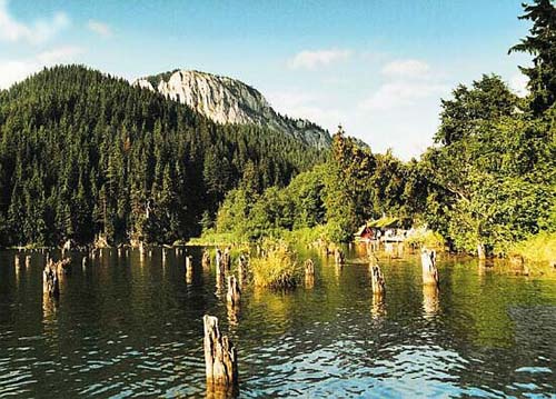
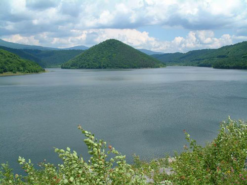
RED-LAKE: It is one of Romania’s most beautiful climatic resorts, being part of the town of Gheorgheni. The distance between Gheorgheni and Lacul Rosu is 29 km. The most important sight of the resort is the lake, one of Romania’s most beautiful lakes. It came into being as a result of a landslide, and it is a naturalraity. What makes this lake unique is the sight of the flooded forest of fir trees. Its importance is increased by the fact that it lies near the Bicaz Gorge. The name of the lake - Killer Lake in Hungarian - was first mentioned by Balazs Orban. In 1837 the heavily soaked clay surface of the side of the Gyilkosko slid and blocked the Bicaz Brook which carried the waters of the mountains. The petrified trunks of the fir trees which once covered the valley can still be seen. The water containing ironoxide and lime preserved these tree trunks. The name "killer" comes, according to the legend, from the fact that during the catastrophe shepherds were grazing their flocks and they were swallowed by the falling earth.
Red Lake and its neighbourhood has a very pleasant microclimate, suitable for people suffering from nervous breakdown, insomnia or recovering from serious illnesses. The average yearly temperature is around 8 degrees C. The warmest months are July and August. The light breeze, the clean air, the streams and the small waterfalls meet the people who like active rest and sports.
Since the turn of the century this “ Seckler Switzerland“ has been a favourite spot for tourists.
 |
 |
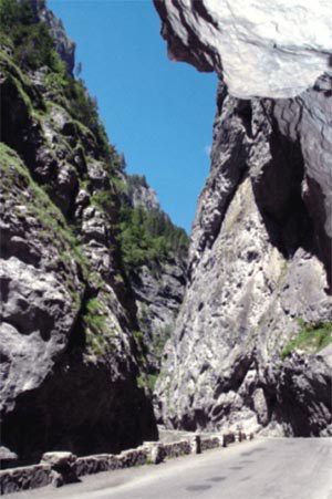
BICAZ GORGE: - is only a few kilometers’ distance from Red Lake. This breathtaking gorge winds among steep 100-300 m tall cliffs. The gorge is the most dramatic pass in the Carpathians. The magic of the place is heightened by the Bicaz Brook rushing through the gorge. The road is flanked by 200-300 m tall cliffs leaving very small room for the road and the brook. The distance between the walls is only 9-10 m in some places. One can often see climbers on the walls of the gorge because this is the place where climbers from the country practice.
 |
 |
 |
The gorge itself is 5 km long. The best-known cliff is the Altar Cliff. It can be of some interest that once the gorge marked the border of Hungary. Even today we find the traces of this fact: the Bridge of the Hungarians on the Bicaz Brook, the road tunnel with the Hungarian royal inscription.
5. SZÉKLEYUDVARHELY (Odorheiu Secuiesc) - HOMORÓDSZENTPÁL (Sânpaul) - KÕHALOM (Rupea) - BRASSÓ (Brasov)- the Black Church - sights seeing - POJÁNA (Poiana Brasov)- ski- paradise - ROZSNYÓ (Râsnov)- the castle - TÖRCSVÁR (Bran)- Bran castle - SZÉKELYUDVARHELY
BRASOV: - The town lies at the foot of the Cenk Mountain. Brasov was a rich commercial town for centuries, and today it is the second biggest city of Romania after Bucharest. The legend says that when the first town hall was built a crown was found among the roots of the trees. The name of the town comes from this crown and the coat-of-arms of the town also contains a crown and roots.
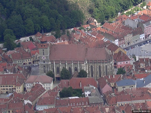
Brasov was the biggest and most important town of the Saxons in Transylvania. Its development started in 1385 when the population was moved to the valley of the Koszoru Brook protected by high mountains. After the Reformation Brasso was one of the pillars of Transylvanian spiritual life, it had Hungarian, Saxon and Romanian schools and cultural institutions. Today the town has 323 thousand inhabitants, 10% Hungarians. The number of the Saxons does not reach one thousand.The most important sight of the town is the Black Church.
 |
 |
This is the biggest church in Transylvania and the easternmost Gothic church in Europe. It was built between 1385-1477 in late Gothic style. It received its present name after a fire, the soot and smoke turned black the walls of the church. The inside of the church is impressive with its high pillars and Gothic windows. The strangest treasure of the church is a collection of more than one hundred Persian rugs which were donated by tradesmen. The neo-Gothic altar of the church was completed in 1866. The pride of the church is the Buchholz organ of 4000 pipes which was made in the middle of the 19th century. Near the entrance to the Black Church there is the statue of Johannes Honterus who spread the evangelic faith among the Saxons. The statue was erected by the citizens of the town in 1898. North from the centre there is the Roman Catholic church in Baroque style which was built at the ned of the 18th century. In the middle of the Main Square there is the old Town Hall which received its Baroque shape in 1770.
Not far from the Main Square there is the cable elevator which takes the visitors up to the top of the 960 m high Cenk Mountain.
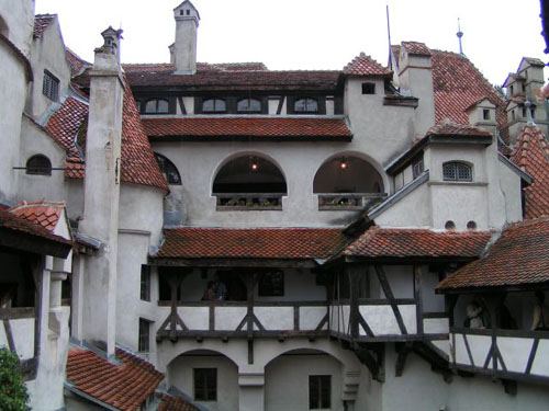
BRAN - The Hungarian King Lajos the Great gave several villages to the town of Brasov in order to build a fortress at Bran. This happened in 1377 and the next year the fortress was ready.
In 1916 the town of Brasov offered it as a present first to Queen Zita, then to the Romanian Queen Maria on the occasion of their crowning. Queen Maria had it restored and it was one of her favourite residences. Today the building is known as Dracula’s castle although it does not gave much to do with the Vallachian prince Vlad Tepes known as Dracula. It is said that he once spent a night in the fortress. Today the castle is a museum with richly furnished rooms.
 |
 |
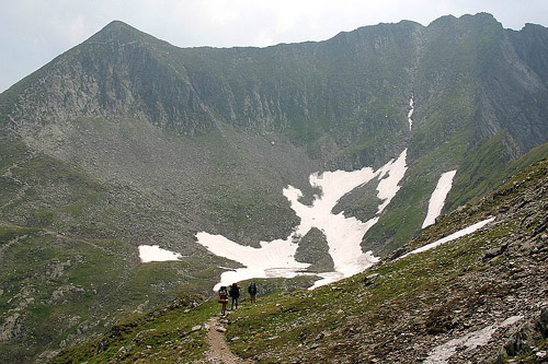
MOUNTAINS OF FAGARAS - The Mountains of Fãgãras situated at the center of Romania, the Mountains of FãgãraS are part of the Carpathians; they are 75 km long, south to the way between Brasov-Sibiu. In the mountains you can find more than 40 glacier lakes, situated in the highest altitude is the Mioarele-lake, at 2282 meters. The defile of Bicaz is the biggest mountain-gorge of the eastern part Carpathians. Walking in the defile we can find rock faces which are 200-300 meter long.
 |
 |
6. SZÉKELUDVARHELY (Odorheiu Secuiesc) - CSÍKSZEREDA (Miercurea Ciuc) - ZSÖGÖD (Jigodin)- Nagy Imre the Sekler painter`s art gallery and memorial house - SEPSISZENTGYÖRGY (Sfântu Geheorghe) - the calvinist church - ILLYEFALVA (Ilieni) - the fortified Reformed church - the Séra monor - ZÁGON (Zagon)- the Mikes monor and memorial house - the Mikes pear trees - CSOMAKÖRÖS (Chiurusi)- the Kõrösi Csoma Sándor& 39;s memorial house - KOVÁSZNA (Covasna) - the deep muddy bottomed slob - SZÉKELYUDVARHELY
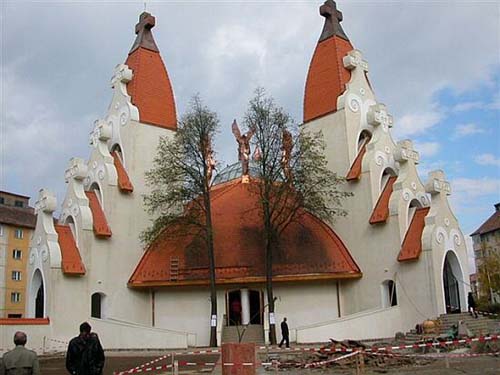
SFANTU GHEORGHE: Sfântu Gheorghe is the oldest town of the Seklers`s Land. Today it is the centre of Covasna County. The town was named after the patron saint of its church, the famous knight St.George. In the second half of the 19th century the town developed into an important cultural centre. The castle church is another important edifice. It was built at the end of the 14th or at the beginning of the 15th century in Gothic style. In the architecture of the town the buildings of Karoly Kos represent an interesting sight. He studied the elements of the typical Seckler architecture and designed the National Seckler Museum, the building of the highschool today named after him, the Reformed Elementary School, the old building of the hospital and several houses. The building of the Seckler National Museum was finished in 1913. Beside the ethnographic and natural history departments there is an exhibition showing the defensive fight of the Secklers in 1848. The County Hall was built in 1832. Today it is the county library. Today the Bazaar is the art gallery housing fine paintings by 20th century Transylvanian painters. Miko Gymnasium is one of the oldest institutions of the Land of the Secklers. The building was built from the donation of Count Imre Miko, “the Seckler Szechenyi”. Very few people know that the famous actress Manyi Kis studied here. The drama company of the town was founded in 1948. Today it is called Aron Tamasi Theatre.Sfântu Gheorghe was once famous for its fairs. Today this tradition is revived by a yearly fair. The St. George Days are held on the day of the patron saint, April 24, when the centre of the town is the scene of several events.
 |
 |
ILIENI: is 8 km south of Sfântu Gheorghe. The whitewashed fortified church , built in 1782-86 and beautifully restored in 1990, dominates the whole area from its hill top. At the bottom of the hill, the Reformat priest has created an ecumenical conference and youth centre, encompassing within its grounds a model farm, meat and dairy processing plants, accommodation in the church& 39;s defensive towers, and a children& 39;s village in which adult couples live with groups of four orphans, staying together for up to twenty years. Illyefalva& 39;s stunning success was made possible by Protestant churches in Western Europe in cooperation with the visionary village minister.
 |
 |
There are two reasons why the 20th century history of Bezid is a tragic one. The inhabitants of this village were converted to Sabbatarianism at the beginning of the 17th century. After 1848 they could openly practice their Jewish faith, but during World War II, although they were Secklers, they were taken to concentration camps and only few returned. The second tragedy marked the end of the village. In the 1980s a dam was built and most of the village was flooded. The inhabitants were moved to different other villages. The buildings of the village stand like a ghost village under the water, only the Catholic church is still visible. The former inhabitants meet in front of the monument built from the bricks of a house on the hill behind the church on the first Sunday of August every year. They inscribed on the wall the names of the former inhabitants as well as the symbols of the different faiths - Catholic, Unitarian, Greek Catholic and Sabbatarian - which once lived together in peace.
 |
 |
BÁLVÁNYOS BATHS: -All-season resort of national importance, situated in central Romania Covasna county, at the southern foot of the Eastern Carpathians in Bodoc Mountains, in 67 Km NE of the municipality of Sfintu Gheorghe (seat of Covasna County).
 |
 |
There are many mineral springs with carbogaseous, ferruginous, calcic, hypotonic waters recommended in treatment of cardiovascular diseases (asthenia neuroses, degenerative and abarticular rheumatic disorders, gastritis with hypoacidity, as at so). The resort has establishments with facilities for warm baths of carbogaseous mineral water in tubs and pools, mofette installations, electrotherapy and hydrotherapy facilities.
ZAGON This village owes its reputation to Kelemen Mikes the memoir writer, who grew up with Ferenc Rakoczi II whom he accompanied in the exile as well. Zagon was the domain of the Mikes family. The Mikes-Szentkereszty manor is a beautiful baroque building built by the Mikes family in 1632, then transformed by the Szentkereszty family. The manor was restored in 1997 and now houses the exhibition of the Zagon Cultural Centre. Beside the Kelemen Mikes memorial exhibition there is the memorial room of a popular Hungarian actress Manyi Kis. In the garden of the manor there is the bust of Kelemen Mikes and a wooden monument.
 |
 |
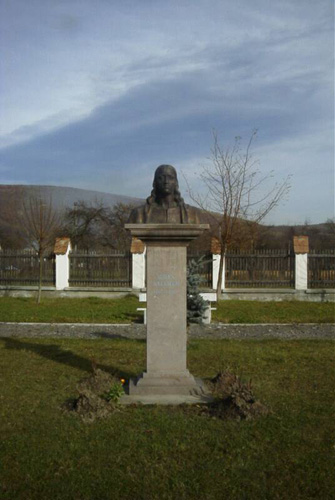 |
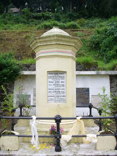
CHIURUS This villlage lies a few kilometers from Kovaszna and was simply called Körös until 1904 when it took the name of Chiurus in honour of Sándor Kõrösi Csoma (1784 – 1842) who was a pioneer of the research into the origins of the Hungarians as well as a great orientalist. The name of this famous scientist made the village known not only for Hungarians but also for the whole world. His bust carved in andesite was erected in 1972. In the former village hall there is now a Csoma memorial room. This village is the only village in Covasna County where women are still engaged in traditional crafts: sieve making and weaving and still make sliver and bast hats.
 |
 |
Covasna is the third town of the county after Sfântu Gheorghe and Târgu Secuiesc. Its soil is rich in different sour mineral waters with curative effect. This is the reason why it is often called “the town of the one thousand mineral waters”. Owing to the waters this town is one of the most important spas of Transylvania. It also has a sanatorium. We can find mineral water sources and eruptions of carbon dioxide everywhere. The cellars and wells are full of carbon dioxide which are dangerous. In the dank and cool caves people used to store meat during the summer. The mineral waters were not only used in hot baths, they were also bottled.
Today the mineral waters of Covasna are only used for bathing. There are several hotels with treatment centres and mofettes. The gas is good for the diseases of the heart and is used together with physiotherapy and medication. The so-called private mofettes in the cellars of the houses are unique in Europe. One of the most interesting tourist sight of the town is the natural sanctuary of mud volcanoes. This is situated in the centre of the town and is called Pokolsár ( Hell’s Mud ). This is a volcano of mud, mineral water and carbon dioxide which was used as a bath. The town has other interesting sights for tourists. One of these is the Reformed church in the old town centre. In front of the church there is the monument honouring the heroes of the Hungarian fight for freedom as well as commemorating one thousand one hundred years since the foundation of the Hungarian state. The town has an art gallery with permanent exhibitions.
 |
 |
7. SZÉKELYUDVARHELY (Odorheiu Secuiesc)- FENYÉD (Brãdesti)- ZETELAKA (Zetea)- the centre of wood cutting and folk wood processing - ZETEVÁRALJA (Subcetate)- the barrage created at the meeting point of the River Tarnava Mare and the Sicasau Stream and its water-basin - IVÓ (Izvoarale) - MADARASI HARGITA (Harghita Mãdãras)- a wonderfool opportunity for skiing in wintertime - SZÉKELYUDVARHELY
ZETEA - s a populous, over 5 000 inhabitants, is a subalpine settlement, one of the great communes of Harghita county. Zetea is the centre of wood cutting and folk wood processing. It is situated in the valley of the upper, montaneous part of the River Tarnava Mare, 11 km from Odorheiu-Secuiesc. The roman- catholic church of Zetea, the largest Catholic church of the region, was built between 1912-14. Gothic remains are preserved in its tower. The Baroque altar was brought here from the mediaeval church. The house no. 204 and the gate of Mrs. Zsigmond Csíki built in 1850 respectively in 1884 are registered monuments of Harghita county. Another Szekler-gate at no. 169 str. Principala is listed among the artistic monuments of Harghita county.
 |
 |
SUBCETATE: - The most significant thing in the village is the barrage created at the meeting point of the River Tarnava Mare and the Sicasau Stream and its water-basin.The village is situated on the montaneous section of the Tarnava Mare. No. 138 county road, 6 km far from Zetea and 19 km from Odorheiu-Secuiesc. This is an artificial lake, aimed at the multi-purpose usage of the water: drinking and industrial water services on the Cristuru-Secuiesc - Sighisoara - Medias line as well as flood-control and obtaining electric energy. The basin can hold almost 50 million cubic metre water. The artificial lake created behind the gate is 2.6 km long and 400-800 m wide. Zete& 39;s Castle`s ruins can be found on the 812 m high Desag mountainside. Zete& 39;s Castle used to control the main road leading to Gheorgheni.
 |
 |
VLAHITA Situated at 860 m above sea-level is the highest
settled city of the county between Odorheiu Secuiesc (25 km) and Miercurea-Ciuc on National Road 13A. The downtown is about 2 km south from the 13A road. The Vlahita spa, towards East (mezotermal mineral baths) and Selters (Székely Szeltersz) spa both in the valley of Vârghis (Vargyas
patak) belongs to the city. The history of the settlement is strongly related with iron processing, through recently the only foundries in the Szeklerland in the industrial era where functioning here. The greatest tourist attraction of the city is the 140-year old foundry, one of the
\r\ nrarest European relics of the history of industrialisation, in function until recently. The foundry is older, than those of Hunedoara, first of his kind in Transsylvania, in the 1836 already in use. In 1848 here where produced the cannon-balls for the Hungarian revolutionary troops. The forge and the smithy-shop is the only, water-fuelled such machinery in the Szeklerland. In the official registry of monuments of Harghita county (1992) registered as monument of history of industrial development. Buildt in 1836, until 1956 was the main supplier of forged industrial products of
the zone. Even today you can find a lot of his products, from smoothing irons to monumental iron-stoves, agricultural tools and machinery all over the zone. After some 45 minutes of hiking toward south-west of downtown Vlahita there is a 300 ha sized zone with the protected narcissus, at 877 m above the sea level. The zone, known as "Pokol-láz" ("Hell-plateau") in
the mid-may through mid June is a sea of flowers with a strong perfume - over 180-200 flowers on square meter can be found here. The zone is protected as nature& 39;s monument according to official registry of monuments of Harghita county (1992).
 |
 |
HARGITA MADARAS: The Harghita Madaras mountain, is the highest top of the center part of the Harghita Mountain. It is 1801 meter high. In the country-side has frequently sulphur-hydrogen and carbon-dioxide gas escapes, kaolin, pirit and ore creatures. The Harghita area is part of Seklers land, a maghyar speaker& 39;s minority, and a picturesque place, full of legends, Today the settlement belongs to Miercurea-Ciuc, and it is a real ski-paradise for the inhabitants.
It is an alpine-type resort lying at 1,300 - 1,400 m altitude. The Kossuth Rock (1,399) rises in the vicinity of the Borhegyese slope. The name of Harghita-Bai is closely related to the kaolin-exploatation, mineral water springs, and mofettes as well as to the vast variety of sport facilities.It is 46 from Odorheiu-Secuiesc, at 1,400 m altitude above sea level. Harghita-Bãi lies in the Central Harghita, at the foot of the Harghita-Ciceu Peak (1,761 m) at 1,350 m altitude. Harghita-Bãi has become famous for its The snow suitable for skiing lasts 4 months a year. In the winter the average snow level exceeds 60 cm.
 |
 |
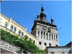
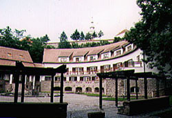
8. SZÉKELYUDVARHELY (Odorheiu Secuiesc)- sightseeing - Jesus’ Heart Chapel - The Székely Támadt castle - the Sekler poet, Tompa László’s memorial house - the Franciscan Curch and Abbey - the Reformed Boarding School - the Benedek Elek Teacher Training School - the Reformed Church - the County Hall - the Tamási Áron Roman Catholic Secondary Grammar School - the Roman Catholic Parish Church - the local Museum
 |
 |
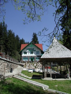
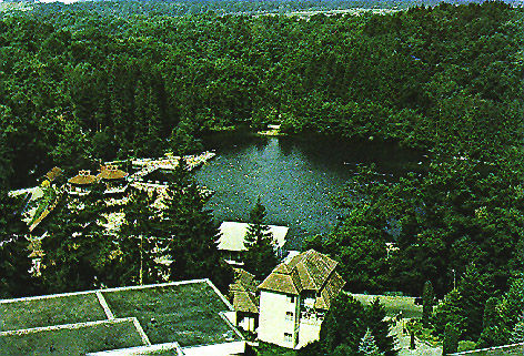
SZEJKE SPA: - is the leisure center and the holiday camp of Odorheiu-Secuiesc. Here can be found a paraffin mineral water, a sulphured warm bath, mofetta and a therapeutic mud, all in one place, in the valley of hte Sós brook, where is a pleasant microclimate. These waters have a curative effect and can be drunk. Its name is closely connected to the activity of Orbán Balázs (1829 – 1890) the greatest Sekler, once the owner of the spa and whose tomb can be found here. He was a writer, historian, ethnographer, publicist and public personality. Here is a tomb- monument, erected in 1969 work of the local sculptor Orbán Áron. The exhibition of 14 Seckler gates would like to present and preserve the ornamentation and folk values of Odorhei District. The hillside is known as Borvízoldal. These gates were erected by the Haáz Rezs? Museum and with the help of people who considered that fostering traditions was their duty. The gate standing in front of the monument was carved in 1888 and was erected by Balazs Orban in front of his former house. Here has been organised the Seiche Folk Festival for more than twenty-five years on Seiche Day. The folk performances held in the open air theatre and are an interesting event every summer.
 |
 |
 |
 |
 |